

Was there a hidden river beneath Egypt’s Great Pyramid of Giza: New evidence rewrites history. world News
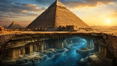
It’s easy to imagine the Great Pyramid of Giza standing isolated against the sand and heat, as if it always belonged to a desert that never changed. That image has shaped how the monument has been discussed for centuries, particularly the question of how such heavy stone blocks reached the plateau. The Nile River today lies several miles away, separated from the site by dry land that seems too wide to be practical for ancient transportation. Nature Studies changes that distance in quiet but unsettling ways, revealing that the landscape was not always arranged this way. Traces buried in the soil point to a waterway that has long since disappeared, something that once flowed much closer to the pyramids than a modern river.
Traces of hidden wetlands beneath the sand of the Great Pyramid of Giza
Beneath the baked surface to the east of the Giza Plateau, layers of sediment hold fragments of the old environment. A team working through these deposits identified microscopic plant remains that do not fit present desert conditions. They included species that are typically tied to marshes and slow-moving water, to species that inhabit the banks of river systems rather than open sand.According to the study published titled ‘Nature’The now abandoned Egyptian pyramid series Ahramat was built along the Nile branch‘, the presence of these remains is consistent with the idea that an ancient branch of the Nile River once passed near the pyramid areas. In modern research it has been named the Khufu Branch, although at the time it may have been another part of the river system. The suggestion is not that the Nile River was entirely separate, but rather that one of its channels has since shifted or disappeared, leaving only faint geological traces behind.
What tiny pollen grains tell us about a forgotten branch of the Nile
The work behind this photo doesn’t rely on anything dramatic at first glance. Instead, it comes from narrow cores dug into the ground, pulling up columns of sediment thousands of years old. Inside those thin specimens are pollen grains that are small enough to be missed without careful sorting.What stands out is not a single plant type but a mixture that is related to wet conditions. Papyrus, sedge-like plants and other vegetation associated with river banks appear together in a way that suggests the presence of continuous water rather than a brief flood event. Pollen taken alone tells very little. Gathered together in layers, they begin to sketch a changing environment. In this case, that points to a functioning waterway near the pyramid complex during the eras of Khufu, Khafre, and Menkaure.
Ancient logs suggest easy water transport to Giza
The second thread comes not from clay but from papyrus. Fragments of records kept by an official named Merer, found in the Red Sea region in Wadi al-Jarf, describe teams carrying limestone under organized supervision. The writing is practical, almost routine in tone, concerned with delivery and transportation rather than ceremony or politics.What makes it relevant is the passage contained in those notes. Stones quarried at Tura are recorded being transported by boat to the Giza area. This simply means only if navigable expanses of water reach close enough to the pyramid site to be useful. Logistics have their own implications. Heavy blocks, barges, a working water corridor that connects the mine and construction lands without the need for long land haulage.When juxtaposed with environmental evidence, the writing begins to feel less like an isolated administrative record and more like a snapshot of a working landscape whose shape has changed.
what was the climate doing in the background
The existence of the now extinct indigo branch is a result of widespread environmental change. North Africa did not always have the arid character that it has today. During a wetter phase thousands of years ago, much of what is now the desert was supported by grasslands, lakes, and seasonal water systems.That period gradually ended as long-term changes in solar patterns altered precipitation across the region. Water sources retreated, vegetation diminished, and channels that once had steady flows began to weaken or disappear. The Khufu branch appears to have been part of a slow return to pyramid-building over the centuries before becoming extinct.There is no sharp break visible in the record. It feels like a drawn-out contraction, a river system gradually losing strength until only the main Nile channel remains dominant.
How waterways may have shaped pyramid building
The image of pyramid construction often assumes a fixed background, as if the geography of Giza had always been stable. What this evidence suggests instead is a setting that was still in transition when the monuments were built.The nearby water route may have changed the practical rhythm of construction. Stone arriving by boat rather than being dragged over long desert trails changed not only efficiency but the entire scale of what was possible. The plateau would have been less isolated, more directly tied into the functioning river network.
what lives under the sand
Today, the Nile River is far from the pyramids, and the space between them seems fixed. Yet the subsurface record tells a different story, where water once reached deep and then slowly retreated. The pollen grains and papyrus fragments are not dramatic evidence in themselves, but together they outline a landscape that no longer exists in visual form.The pyramids remain where they were placed, but the river that would have aided in their construction no longer runs through them.